|
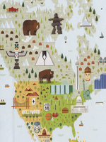
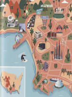
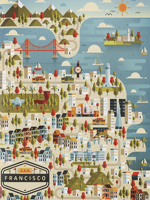
This book is a selection of different ways of interpreting a map of illustration level. Various artists have created maps of the most beautiful places in the world and major cities: Paris, Berlin, Dubai, Rio de Janeiro ...
Colorful illustrations in which each artist shows her how to work with lines, geometric shapes, some very detailed other highly synthesized, made with computer, watercolors or simply pen ... Studio Muti, Marcus Oakley, Katie Vernon, Jackkrit Anantakul, Olaf Hajek are just some of the artists who collaborate in this great work.
|